UN
132 Park Lane
£ 140,000
Description
We don't have a Description for this property.
- Bedrooms
- 3
- Bathrooms
- 0

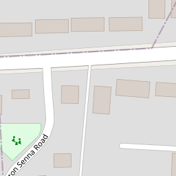


Leaflet © OpenStreetMap contributors
The heatmap indicates the level of crime in the area. The color of the heatmap indicates the crime severity and recency.
Metrics Year-on-Year
- Average area value
- 426,071.00 £Increased by 3.84 %
- Average area rental value
- 1,560.00 £/moIncreased by 1.36 %
- Est rental Yield
- 4.39 %Decreased by 2.44 %
- Crime Rate
- 4.00 %Unchanged by 0.00 %
from 410,323.00 £
from 1,539.00 £/mo
from 4.50 %
from 4.00 %
Nearby Schools
| Name | Type | Ofsted | Distance |
|---|---|---|---|
| St Paul'S Catholic Primary School | Voluntary Aided School | Good | 0.42 KM |
| Park Lane Primary School | Community School | Good | 0.60 KM |
| Birch Copse Primary School | Community School | Outstanding | 0.71 KM |
| Springfield Primary School | Community School | Good | 0.92 KM |
| Tlg Reading | Other Independent School | Good | 1.05 KM |
Images
Nearby Streets
| Name | Average Price | Average Sqft | Distance |
|---|---|---|---|
| Boundary Close | £ 450,000 | 0 | 0.00 KM |
| Blagrave Cottages | £ 450,000 | 0 | 0.00 KM |
| Hayfield Close | £ 0 | 0 | 0.00 KM |
| Ashbury Drive | £ 0 | 0 | 0.00 KM |
| Fern Close | £ 450,000 | 0 | 0.00 KM |
Nearby Transport
| Name | NLC | TLC | Distance |
|---|---|---|---|
| Tilehurst | 3154 | TLH | 2.80 KM |
| Theale | 3153 | THE | 3.80 KM |
| Pangbourne | 3036 | PAN | 6.08 KM |
| Reading West | 3160 | RDW | 6.24 KM |
| Reading | 3149 | RDG | 8.28 KM |
Nearby Listings
| Address | Price | Type | Score | Distance |
|---|---|---|---|---|
| Park Lane, Tilehurst, Reading, RG31 | £ 325,000 | BUY | 4 / 10 | 0.07 KM |
| Park Lane, Tilehurst, Reading, Berkshire, RG31 | £ 500,000 | BUY | 6 / 10 | 0.08 KM |
| Park Lane, Tilehurst, Reading | £ 300,000 | BUY | Unknown | 0.12 KM |
| Glenwood Drive, Tilehurst, Reading | £ 395,000 | BUY | Unknown | 0.12 KM |
| Portland Gardens, Tilehurst, Reading, Berkshire, RG30 | £ 500,000 | BUY | 7 / 10 | 0.20 KM |
Nearby Properties
| Address | Price | Distance |
|---|---|---|
| 124 Park Lane | £ 315,000 | 0.00 KM |
| 118 Park Lane | £ 315,000 | 0.00 KM |
| 114 Park Lane | £ 242,000 | 0.00 KM |
| 104 Park Lane | £ 370,000 | 0.00 KM |
| 132 Park Lane | £ 140,000 | 0.00 KM |